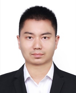
一、个人简介
尹超,博士,2022年9月入职广州地理研究所。主要从事LiDAR点云智能处理、三维BIM模型重建和GIS应用研究。主持国家博士后面上基金项目1项,参与国家和地方科技项目多项,发表SCI论文9篇,其中,以第一作者发表中科院一区Top论文3篇。
二、学历背景
(1)2018.08—2022.09,香港科技大学,哲学博士(土木工程学),导师: Prof. Jack C.P. Cheng(郑展鹏教授)
(2)2011.09—2013.07,武汉大学,地图学与地理信息系统,硕士(学术),导师:付仲良教授
三、工作经历
2022.09—,广州地理研究所,
2017.08—2018.06,香港理工大学,土地测量及地理资讯学系,访问学者/研究助理,合作老师:史文中教授
2013.07—2018.06,衡阳师范学院,地理与旅游学院、协同创新中心,GIS专业教师
2012.02—2013.03,北京洛斯达科技发展有限公司,GIS研发工程师(实习)
四、研究领域与研究方向
点云智能处理、深度学习、三维场景感知、BIM三维重建和GeoAI
五、科研成果
1.论文(* 代表通讯作者)
[1] C. Yin(第一作者), B. Yang, J. C. P. Cheng*, V. J. L. Gan*, B. Wang, and J. Yang, “Label-efficient semantic segmentation of large-scale industrial point clouds using weakly supervised learning,” Automation in Construction, vol. 148, p. 104757,2023. (SCI, 中科院一区Top)
[2] C. Yin(第一作者), J. C. P. Cheng*, B. Wang, and V. J. L. Gan*, “Automated Classification of Piping Components from 3D LiDAR Point Clouds using SE-PseudoGrid”, Automation in Construction, vol. 139, p. 104300, Jul. 2022. (SCI, 中科院一区Top)
[3] C. Yin(第一作者), B. Wang, V. J. L. Gan, M. Wang*, and J. C. P. Cheng*, “Automated semantic segmentation of industrial point clouds using ResPointNet++,” Automation in Construction, vol. 130, p. 103874, October 2021. (SCI, 中科院一区Top)
[4] Q. Han, C. Yin*(通讯作者), Y. Deng, and P. Liu, “Towards Classification of Architectural Styles of Chinese Traditional Settlements Using Deep Learning: A Dataset, a New Framework, and Its Interpretability,” Remote Sensing, vol. 14, no. 20, Art. no. 20, Oct. 2022. (SCI, 中科院二区)
[5] B. Wang, Z. Chen, M. Li, Q. Wang, C. Yin, and J. C. P. Cheng, “Omni-Scan2BIM: A ready-to-use Scan2BIM approach based on vision foundation models for MEP scenes,” Automation in Construction, vol. 162, p. 105384, Jun. 2024. (SCI, 中科院1区Top)
[6] D. Hu, V. J. L. Gan, and C. Yin, “Robot-assisted mobile scanning for automated 3D reconstruction and point cloud semantic segmentation of building interiors,” Automation in Construction, vol. 152, p. 104949, Aug. 2023. (SCI, 中科院1区Top)
[7] B. Wang, C. Yin, H. Luo, J. C. P. Cheng*, and Q. Wang*, “Fully automated generation of parametric BIM for MEP scenes based on terrestrial laser scanning data,” Automation in Construction, vol. 125, p. 103615, May 2021. (SCI, 中科院一区Top)
[8] B. Wang, Q. Wang*, J. C. P. Cheng*, C. Song, and C. Yin, “Vision-assisted BIM reconstruction from 3D LiDAR point clouds for MEP scenes,” Automation in Construction, vol. 133, p. 103997, Jan. 2022, doi: 10.1016/j.autcon.2021.103997. (SCI, 中科院一区Top)
[9] B. Wang, Q. Wang*, J. C. P. Cheng*, and C. Yin, “Object verification based on deep learning point feature comparison for scan-to-BIM,” Automation in Construction, vol. 142, p. 104515, Oct. 2022, doi: 10.1016/j.autcon.2022.104515. (SCI, 中科院一区Top)
2.会议论文(* 代表通讯作者)
[10] C. Yin(第一作者), B. Wang, and Cheng J.C.P.*, 2019. Deep learning-based scan-to-BIM framework for complex MEP scene using laser scanning data. 4th International Conference on Civil and Building Engineering Informatics(iccbei2019), Sendai, Japan, November 7- November 8, 2019.
[11] C. Yin(第一作者), Cheng J. C. P.*, B. Wang, and V. J. L. Gan, 2022. Automated classification of piping components from 3d LiDAR point clouds using deep learning and squeeze-excite mechanism. 9th International Conference on Innovative Production and Construction (IPC2022), Melbourne, Australia, June 27-June 30, 2022.
[12] V.J.L. Gan, T. Wang, D. Hu and C. Yin, 2021. Developing an Integrated Data Model based on IFC and SensorML for Post-COVID Facility Management. 19th International Conference on Smart City, 2021.
3.专著
[13] C. Yin, B. Wang, K. Chen, H. Liu, C. Huang, J. C. P. Cheng* and Long Chen, 2022. Digital modelling layer: two digital modelling methods, In Q. Lu, X. Xie, A.K. Parlikad, J. Schooling and M. Pitt (editors), Digital Twins in the Built Environment: Fundamentals, principles and applications, ICE Publishing, 2022, pp. 101–159. (英文专著章节)
六、科研项目(近五年)
[1].2023-09—2024-12,中国博士后科学基金会, 面上资助, 基于深度长尾学习的三维点云弱监督智能语义分割方法研究, , 8万元, 在研, 主持
[2].2019.09—2020.12,香港科技大学学校项目, Digital Twins for HKUST Campus,香港科技大学,港币90万,完结,参与
[3].2018.08—2021.12,香港创新及科技基金项目, Automated BIM Generation Based on UAV and Indoor 3D Laser Scanning Technologies (UIM/344),香港科技大学,港币340万,完结,主要参与人
[4].2017-08至2018-06,香港创新及科技基金项目, Develop 3D Geodatabase Framework for Hong Kong (ITP/053/16LP),香港理工大学,港币606万,完结,参与
七、获奖情况
国际会议ICCBEI 2019(4th International Conference on Civil and Building Engineering Informatics), 最佳论文奖(the Best Paper Award),2019年,日本仙台,排名第一。
八、联系方式
地址:广州市越秀区先烈中路100号大院广州地理研究所
邮编:510070
邮箱:chao.yin@connect.ust.hk, chaoyin@gdas.ac.cn
个人网页及论文代码:https://github.com/PointCloudYC


